Ha Giang Loop: Practical Trekking Tips for Independent Adventurers
A practical guide for international trekkers planning to explore the Ha Giang Loop in Vietnam’s northern highlands. Covers transportation, permits, route options, accommodation, and essential preparation for a self-guided trekking experience.

Related reading
Keep exploring Vietnam
- 1Best time to visit Ha Giang: weather, roads, and scenic routes
Link from 'Essential Preparation' section to help readers plan around weather and trail conditions.
- 2Ha Giang Loop Practical Guide 2026: Costs, Permits, and Safety for International Travelers
Link from 'Permits and Local Regulations' section for deeper info on permits and safety.
- 3Budget Backpacking the Ha Giang Loop: 2026 Costs, Transport, and Tips
Link from 'Accommodation and Food' section for advice on budget stays and meal options.
At a glance
- Best time to visit
- September–November or March–May
- Recommended duration
- 3–5 days for a trekking loop
- Budget
- From $30–50 USD/day (including accommodation, food, and guides)
- Getting there
- Sleeper bus from Hanoi (6–8 hours)
- Language
- Vietnamese, minority languages; little English outside main towns
- Currency
- Vietnamese Dong (VND)
Getting There and Around
Ha Giang city is about 300 km from Hanoi. The most common way to reach it is by overnight sleeper bus (6–8 hours; around 350,000–500,000 VND). Private cars or minivans are also available, but more expensive. Once in Ha Giang city, trekkers can arrange local transport to trailheads or villages, often by taxi or hired car. Public transport within the province is limited, so flexibility is important.
Permits and Local Regulations
All foreign visitors must obtain a Ha Giang permit (about 230,000 VND), available at police stations or most hostels in Ha Giang city and Meo Vac. Permits are usually checked at police checkpoints along the loop. Some trekking routes cross private or agricultural land; use established paths and ask for permission if uncertain. Trail conditions can change with weather or road construction, so check with local guides or accommodation for updates.
Trekking Routes and Highlights
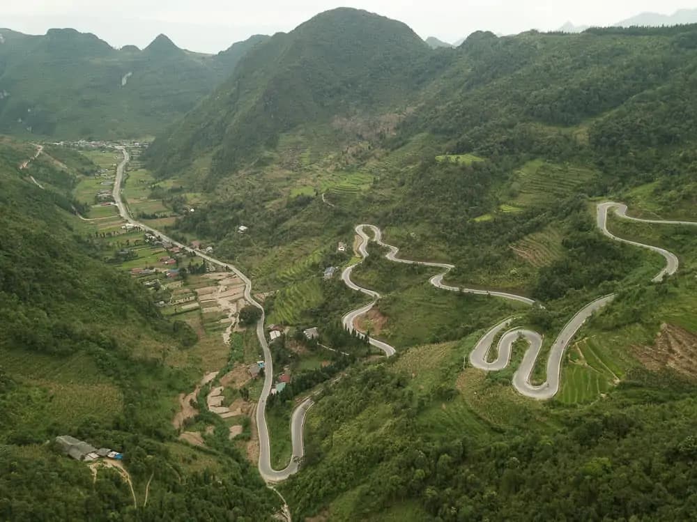
Popular trekking areas include the Dong Van Karst Plateau Geopark (a UNESCO site), Ma Pi Leng Pass, and villages like Nam Dam, Lung Cu, and Meo Vac. Routes range from short village walks (2–4 hours) to multi-day hikes (2–4 days) linking several towns. The scenery includes limestone peaks, deep valleys, and terraced rice fields. Most trails are not clearly marked; hiring a local guide is recommended for navigation and cultural interpretation.
Accommodation and Food
Accommodation is mainly homestays in ethnic minority villages (200,000–400,000 VND per night, including meals) or simple guesthouses in larger towns. English is limited outside Ha Giang city. Meals are typically home-cooked and based on local produce—rice, vegetables, pork, and sometimes corn wine. Vegetarian options are possible but should be requested in advance.
Essential Preparation
Bring enough cash for your entire trek, as ATMs are rare outside Ha Giang city. Mobile coverage is unreliable in remote areas; download offline maps and translation tools. Weather can change quickly, especially from September to November and March to May. Pack waterproof layers, sturdy hiking shoes, and basic first aid. Always confirm trail conditions locally before setting out.
Frequently asked questions
While not mandatory, a local guide is highly recommended due to unmarked trails, language barriers, and cultural sensitivity.
Yes, but you’ll need to arrange local transport to trailheads and plan for longer hiking times between villages.
ATMs are scarce outside Ha Giang city, and mobile coverage is unreliable in remote areas. Bring enough cash and download offline maps.
Travel details change — opening hours, prices, and schedules can vary by season. Please verify current information on official websites before your visit.
Sources
- backpackerswanderlust.com — Primary source
- nomadasaurus.com — From research brief
- wanderingwheatleys.com — From research brief
- vietnamcoracle.com — From research brief
- lonelyplanet.com — From research brief
Loading reviews…
About the author
Võ Hoài Nam
Nature & Adventure Editor
Hoài Nam edits Vietpeep's national parks, trekking, and adventure coverage from an environmental perspective. He keeps trail conditions, permits, wildlife rules, and low-impact travel choices front and center, so readers can plan a trip that respects the landscape.
All articles by Hoài NamRelated posts
Ha Giang Loop 2026: Vietnam Travel Tips for Permits, Easy Rider Costs, and Self-Drive Rules
This Ha Giang Loop 2026 guide gives first-timers the practical Vietnam travel tips they need: border permits, Hanoi-to-Ha Giang transport, 3-day costs, self-drive versus easy rider, police checks, and seasonal timing. It uses one set of prices and dates so you can budget and book without conflicting numbers.

Ha Giang Loop Safety 2026: Accident Prevention, Costs, and Sapa Trekking Alternatives
A 2026 safety guide for riding Vietnam's Ha Giang Loop. Covers road hazards, wet-season dangers, licence and insurance rules, easy rider versus self-drive costs, and practical packing tips. Includes Sapa trekking as a lower-risk alternative for travellers who want northern Vietnam's mountain scenery without motorbike risks.
Ha Giang Loop Safety and Police Checks: Vietnam Travel Tips 2026 for First-Timer Riders
The safest months for the Ha Giang Loop in 2026 are September to November and March to May. Avoid June to August for monsoon rain and landslides. Police checkpoints can fine 800,000 to 2 million VND for licence, helmet, or permit problems. This FAQ hub answers first-timer safety questions with 2026 costs, paperwork rules, and Vietnam travel tips.