Ha Giang Loop Weather in 2026: Month-by-Month Guide
This guide breaks down the Ha Giang Loop month by month for 2026: temperatures, road conditions, scenery and crowds. It explains why September to November is the most reliable window, what winter fog and summer rain mean for riders, and how to check road conditions before you depart.

Related reading
Keep exploring Vietnam
- 1
- 2
- 3
At a glance
- Best time
- September to November for clear skies; February to April for cool, drier weather and blossoms.
- How long
- 3 to 4 days for the 300 to 350 km loop, riding 6 to 8 hours each day.
- Budget
- No separate trail permit fee; costs for bike rental, fuel, food and homestays vary by season.
- Getting there
- The loop starts and ends in Ha Giang City, passing Quan Ba, Yen Minh, Dong Van, Meo Vac and Ma Pi Leng Pass.
- Language
- Vietnamese; basic English is common at tourist homestays and guesthouses.
- Currency
- Vietnamese dong (VND), with cash needed at small fuel stops and homestays.
When to ride: the short answer
September to November is the safest time to ride the Ha Giang Loop, a 300 to 350 km circuit that takes 3 to 4 days, starting and ending in Ha Giang City. The route passes through Quan Ba, Yen Minh, Dong Van, Meo Vac and Ma Pi Leng Pass. Elevation runs from about 100 m in the river valleys to 1,500 to 1,700 m on the passes, so how you dress and what you see can change sharply within an hour.
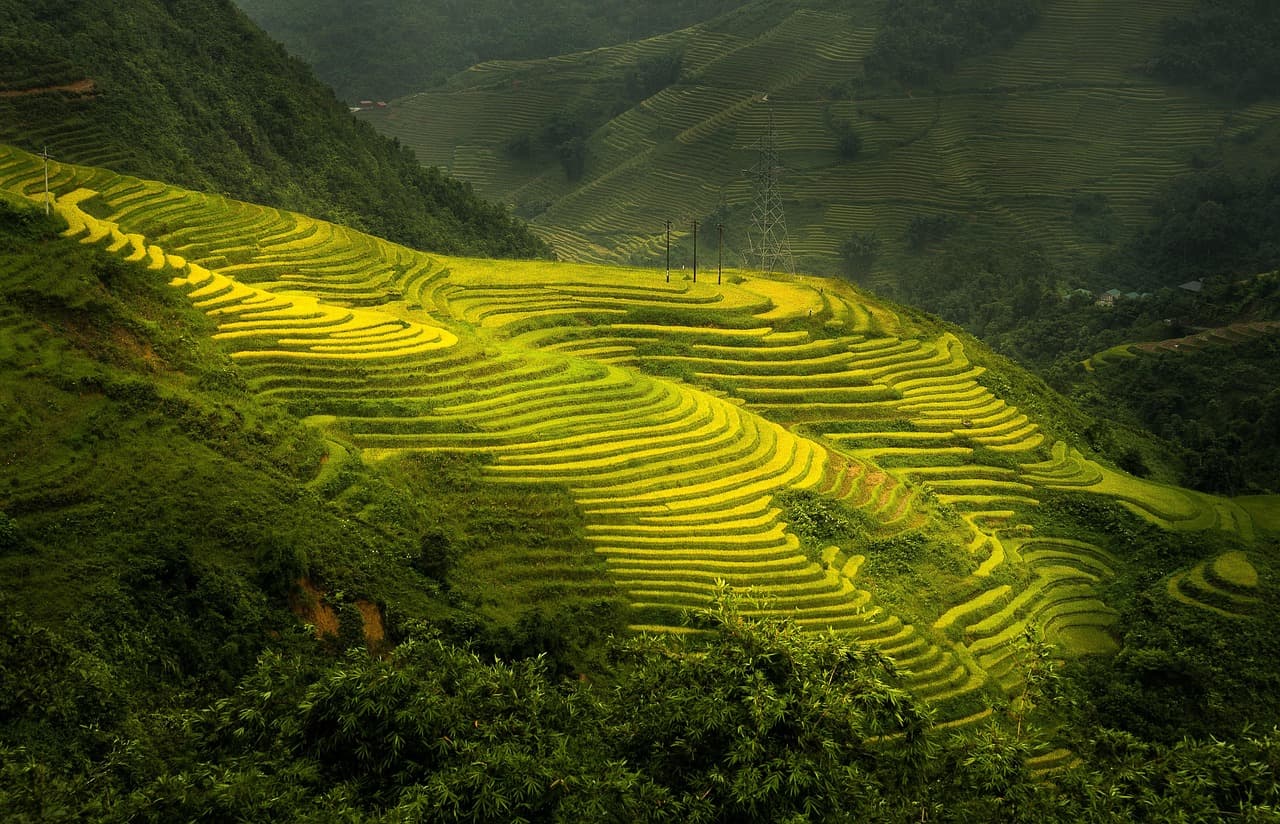
That autumn window works because it follows the wettest months. Roads are drier, skies are more reliable, and the risk of landslides drops compared with July and August. Late September and October add the two most photographed scenes on the route: golden rice terraces and buckwheat flowers spread across the karst plateau. Mornings on the passes can be foggy, but the cloud cover often burns off by midday.
February to April is a solid runner-up. The weather is cooler and drier, and peach and plum blossoms come out around Tet. Tet 2026 falls around 17 February, when homestays are typically fully booked and many food stops close for 1 to 3 days. If you ride during that window, book your beds in advance and carry warm layers, because December to February nights drop to 3 to 8°C.
The rest of the year brings trade-offs. May is hot, with afternoon highs of 25 to 32°C. June through August is the wettest stretch and has the highest landslide risk, especially in July and August. December and January are cold and often foggy on the passes, so the views at Ma Pi Leng can be hit or miss. Whichever month you choose, confirm road conditions with your guesthouse before setting out; landslides and rockfall near Meo Vac and Yen Minh have been known to close sections for hours or days.
September to November in detail
September to November is when the Ha Giang Loop's weather, roads and scenery line up. The summer rains have stopped, so the 300 to 350 km route from Ha Giang City through Quan Ba, Yen Minh, Dong Van and Meo Vac is free of the worst mud and rockfall. The high passes at Heaven Gate and Ma Pi Leng, both around 1,500 to 1,700 m, get clear autumn air, and the views down the Nho Que River valley appear instead of hiding in cloud.
Plan for 6 to 8 hours of riding per day, the same pace that defines the loop's usual 3 to 4 day itinerary. The distance is manageable, but the road is a series of tight switchbacks, and each stop for a viewpoint, a bowl of noodle soup or fuel turns a half-day of riding into a full one. If you are self-driving, check current conditions at your guesthouse each morning. A sudden autumn storm can still bring down rock onto sections near Meo Vac or Yen Minh, closing the road for hours.
Book beds in Ha Giang, Yen Minh, Dong Van and Meo Vac in advance for the final week of September. That is when the buckwheat fields bloom and Vietnamese holidaymakers travel north, and the homestays with the best terraces fill first. For the rest of autumn, arriving without a reservation usually works, but late September does not. Carry sun protection and a rain shell on every ride, no matter how clear the morning looks. You can cross several climate zones in a single hour on the passes, and the temperature drops noticeably from the valley floor to the top of the climb.
Autumn is the safest time to ride the loop, and also the busiest. Start early from Ha Giang City to get to Ma Pi Leng before the tour groups, and book your late September homestay at least a week ahead. Do that, and you trade a crowded season for its best conditions.

Winter and Tet: December to February
From December to February, night temperatures on the Ha Giang Loop drop to 3 to 8 degrees C. You need a serious winter jacket, gloves, and warm layers for the evenings and the pre-dawn starts; a buff and beanie help too. Daytime riding is often pleasant in the sun, but the wind on a motorbike cuts through fast.
Fog is the bigger problem in December and January. It sits on the passes for much of the morning, and sometimes all day. The Ma Pi Leng overlook can be a wall of grey, and the views from Heaven Gate and other high points are hit or miss. If you have flexibility, watch the forecast and delay a day when the passes are clear. Roads are usually dry in winter, but black ice is possible on shaded sections above 1,500 m in the early morning.
Tet changes the rhythm of the loop. Lunar New Year 2026 falls around 17 February, and homestays fill up well ahead of it. Food shops and family-run cafes can stay closed for 1 to 3 days around Tet, so carry snacks and confirm with your guesthouse that meals will be available. Many riders enjoy the festive atmosphere, but if you want quiet roads and open kitchens, aim for late January or early March instead.
From late February into April, cool, drier weather returns and the hills bloom with peach and plum blossoms. This is the second-best season on the loop, after autumn. The rice terraces are not golden as they are in September and October, but the clear skies and occasional flower orchards make up for it. Pack layers, check road conditions before you leave, and you will find the passes empty and sharp.
May to August: hot and wet
By May the Ha Giang Loop is already hot, with summer afternoons reaching 25 to 32 deg C in the lower river valleys. The dry heat of spring gives way to humidity as the monsoon builds, and afternoon downpours become routine. The landscape turns intensely green, but the trade-off is road risk.
The wettest stretch runs from June to August, and the highest landslide and rockfall risk falls in July and August. Sections near Meo Vac and Yen Minh can close for hours or days after heavy rain. A clear morning can turn into a blocked pass by early afternoon. Check with your guesthouse the morning before departure, then ask again at each stop if you are riding the full 3 to 4 day loop. Local homestay staff and other riders are the most current source, and they will know about overnight closures that forecast apps cannot predict.
Rainy-season riders need solid wet-road handling skills. Paved sections get slick, and the unpaved segments east of Meo Vac become rutted mud. Carry a proper rain shell, not just a poncho, and pack your phone, camera, and documents in a dry bag. Expect to ride slower and stop more often. The standard 6 to 8 hours per day of riding can stretch longer when you add rain delays, so build in a buffer if you have a fixed flight or train out of Hanoi. If you are a less confident rider, this is the one season when hiring an easy-rider is a sensible alternative to self-driving.
For all the risk, summer has its rewards. The rice terraces are at their most vivid, waterfalls run full, and the fog that hangs in the valleys clears to sharp views on Ma Pi Leng Pass. You will also share the road with fewer motorbikes than in October. Just treat July and August as the most demanding window on the loop, not the season for a first ride.

Licences and road conditions in 2026
Riding the Ha Giang Loop does not require a separate trail permit, but the licence rules for foreign riders are not fully settled in 2026. Vietnamese official wording is inconsistent: some agencies and rental shops accept an International Driving Permit, while others require a Vietnamese temporary licence. The loop covers 300 to 350 km from Ha Giang City through Quan Ba, Yen Minh, Dong Van, Meo Vac and Ma Pi Leng, and takes 3 to 4 days. Confirm the current rule with your rental operator before you decide to self-drive, and ask them to state what they accept in writing.
If you cannot get a straight answer, book an easy rider and travel as a passenger. That removes the licence question entirely, and many visitors complete the loop this way. The route climbs from 100 m in the valley floors to 1,500 to 1,700 m at Heaven Gate and Ma Pi Leng, so the ride demands 6 to 8 hours on the bike each day. An easy rider also means you avoid relying on your own wet-road handling skills during the rainy season, and you can focus on the scenery.
Road conditions add another layer of planning. Repaving between 2023 and 2025 smoothed many stretches, but some gravel segments remain east of Meo Vac. Heavy rain can bring landslides and rockfall that close parts of the route near Meo Vac and Yen Minh for hours or days. Check current conditions on local travel forums and with guesthouses the morning before departure, and do not rely on a website that has not been updated in months. Provincial weather forecasts do not capture micro-level conditions on the passes, so carry both sun protection and a rain shell in every season.
The wettest months are June through August, with July and August carrying the highest landslide risk. If you ride then, plan for possible delays and keep your schedule loose.
Book homestays and pack for both extremes
Tet 2026 lands around 17 February, and it is the one date when you should book Ha Giang Loop homestays weeks ahead. The loop runs 300 to 350 km over 3 to 4 days through Quan Ba, Yen Minh, Dong Van, and Meo Vac, and during Tet those towns fill up while many food stops close for 1 to 3 days. Christmas and late September (buckwheat flower season) are almost as busy. Outside those peaks, you can usually decide your overnight stop the same morning and still find a bed.
Packing for the loop means dealing with both extremes. Winter nights from December to February drop to 3 to 8°C, so riders need thermal layers, a fleece or down jacket, and gloves for early starts. Summer afternoons reach 25 to 32°C, which calls for lightweight, breathable riding gear and hydration. Altitude runs from 100 m in the valley floors to 1,500 to 1,700 m on the passes; the climb to Heaven Gate or Ma Pi Leng is where you feel the swing most.
A rain shell and sun protection belong in every bag, no matter the season. Provincial forecasts are not reliable at individual pass level, so a clear morning near Yen Minh can turn to fog or drizzle on Ma Pi Leng by early afternoon. Pack a compact rain jacket that fits over your layers, plus a brimmed hat and sunscreen for exposed sections. Check the road with your guesthouse before leaving each morning, because sections near Meo Vac and Yen Minh can close after heavy rain.
Expect to ride 6 to 8 hours a day, so start early and plan rest stops in Dong Van and Meo Vac. An early departure gets you over the highest passes before the worst heat or fog and leaves a buffer for photo stops. Flexible homestay plans support this: on a 3 to 4 day loop, you can slow down when roads are wet and still finish each day at a reasonable hour.

Frequently asked questions
No separate trail permit is required for the loop itself. You still need a valid driving licence if you ride yourself, and enforcement rules for foreign licences were inconsistent for 2025 to 2026, so confirm locally or consider an easy rider.
The loop is 300 to 350 km and usually takes 3 to 4 days. With 6 to 8 hours of riding daily, 3 days is tight, while 4 allows for fog delays, photo stops and breaks in Dong Van and Meo Vac.
May to August is hot and wet. The highest landslide and rockfall risk is in July and August, especially near Meo Vac and Yen Minh. Check current road reports with guesthouses before setting out and avoid riding during or right after heavy rain.
Travel details change — opening hours, prices, and schedules can vary by season. Please verify current information on official websites before your visit.
Watch: related videos
Ha Giang Loop Weather in 2026: Month-by-Month Guide — Video by MapKoi Travel on Pexels · silent stock clip
Ha Giang Loop Weather in 2026: Month-by-Month Guide — Video by MapKoi Travel on Pexels · silent stock clip
Sources
- wander-lush.org — Primary source
- vietnamcoracle.com — From research brief
- saltinourhair.com — From research brief
- vietnam.travel — From research brief
- roughguides.com — From research brief
Loading reviews…
About the author
Võ Hoài Nam
Nature & Adventure Editor
Hoài Nam edits Vietpeep's national parks, trekking, and adventure coverage from an environmental perspective. He keeps trail conditions, permits, wildlife rules, and low-impact travel choices front and center, so readers can plan a trip that respects the landscape.
All articles by Hoài NamRelated posts
Sapa Trekking vs Ha Giang Loop: 2026 Season, Permits and Cost Comparison
This guide compares Sapa trekking and the Ha Giang Loop for 2026, covering the best months, permitting rules, guide rates, and homestay prices. It helps you decide whether to walk through Hmong and Red Dao villages or ride the Ma Pi Leng Pass on a motorbike without overpaying.

A Practical Guide to the Ha Giang Loop: Vietnam’s Most Scenic Motorbike Route
A practical guide to the Ha Giang Loop, covering transport from Hanoi, motorbike rental, licensing, best months, route distance, key stops, accommodation, cash, mobile coverage, safety, and local etiquette on Vietnam's most scenic motorbike route.
Ha Giang Loop by Guided Tour: A 5-Day Motorcycle Adventure for International Visitors (2026)
The Ha Giang Loop offers a challenging and scenic motorcycle journey through Vietnam’s far north. This 2026 itinerary focuses on guided tours for international visitors, covering essential logistics, updated prices, entry rules, and practical tips for a safe and immersive experience.